Monday, September 12, 2011

MANDANGAD

kanchan athalye | Monday, September 12, 2011 | Best Blogger Tips
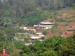
 Mandangad Is The Taluka (Tahasil) Head Quarter In Ratnagiri District Of Maharashtra State In India. The Place Is Situated At Extreme North Of Ratnagiri District. In Terms Of Geographical Features, Mandangad Is A Hilly And Coastal Zone The Taluka Was Neglected For Years, Now It Has Emerged As A Significant Zone In View Of Its Natural Beauty, Seashore, Lush Green Jungles And Pleasant Weather Conditions. The Taluka Is Almost Surrounded By Hills, Ghats And Valleys. Mandangad Is Absolutely Free From Air & Sound Pollution The Arabian Sea Is About 35 Km From Mandangad. There Are Villages Named As Devhare And Konhavali, Which Are Famous For Tasty Alphonso (Haapoos) Mangoes.


Stumble
Delicious
Technorati
Twitter
Digg
Facebook
Reddit
Feed

If you like this please Link Back to this article...


Stumble Upon Toolbar

Saturday, September 10, 2011

Konkan Ghats

kanchan athalye | Saturday, September 10, 2011 | Best Blogger Tips
 A road with lots of curves in a mountain is called as “Ghat” Two mountain ranges of southern India, separated by the Deccan Plateau. The Eastern Ghats extend about 1,448 km (900 mi) along the coast of the Bay of Bengal. The Western Ghats extend about 1,609 km (1,000 mi) along the coast of the Arabian Sea.


KONKAN GHATS

  • Kashedi ghat – Mumbai  to  Goa

  • Parshuram ghat -
  • Karnala ghat -
  • Kamthe ghat -
  • Nivali ghat - Here one nice waterfall can be seen while passing through
  • Watul ghat -
  • Akeri ghat near Sawantwadi
  • Insuli ghat near Banda
  • Sukeli ghat - near Sukeli
  • Dahanu ghat - Nasik through Javhar ghat

GHATS CONNECTING KONKAN AND DECCAN

  • Khandala ghat - Mumbai- Khopoli - Lonavala-Pune
  • Kumbharli ghat - Chiplun to Umbraj towards Pune
  • Amba ghat - Ratnagiri to Kolhapur
  • Varandh ghat - from Mahad to Pune via Varandh & Bhor
  • Ambenali ghat to Mahabaleshwar from Poladpur
  • Amba ghat to Kolhapur from Ratnagiri
  • Phonda ghat to Kolhapur from Phonda Kankavali
  • Anuskura ghat to Kolhapur from Rajapur
  • Amboli ghat to Kolhapur-Belgaum from Sawantwadi
  • Bhuibavda ghat to Kolhapur - Bhuibavda via Vaibhavvadi
  • Kashedi ghat Mumbai to Goa between Khed - Poladpur
  • Karul ghat via Vaibhavwadi to Gaganbavda -Kolhapur
  • Tamhane ghat - Mangaon to Pune
  • Kasara ghat - Mumbai - Nasik
  • Malshej ghat - Kalyan - Alephata - Junnar
Stumble
Delicious
Technorati
Twitter
Digg
Facebook
Reddit
Feed

If you like this please Link Back to this article...


Stumble Upon Toolbar

DAPOLI

kanchan athalye | Saturday, September 10, 2011 | Best Blogger Tips
 Dapoli Is Hill Station In Ratnagiri District.There Are So Many Places Around Dapoli - Beaches - Temples, Caves, Forts. It Is A Small Yet Nice Place. It Is At A Height Of 700 To 800 Feet From The Sea Level. Dapoli Is A Cool  Pleasant Place. As It Is Located At A Height, It Is Surrounded By Beautiful Natural Surroundings. People Are Attracted To Dapoli Village Because Of Its Natural Beauty. In Summer Holidays & Christmas Holidays, People Especially From Mumbai & Pune Come To Spend Their Time. The Britishers Selected Dapoli As The Place For Their Military Camp Being Cool Place. So It Came To Be Known As Camp Dapoli.
The Camp Consists Of Dapoli, Gimhavane, Jogale & Jalgaon. In The Year 1880 Alfred Gaddne Started A High School (A.G.High School). Many Well Known People Were The Students Of This School. Bharat Ratna, P.V. Kane & Bharat Ratna Dr. Babasaheb Ambedkar Had Studied From This School.

World famous Agriculture College called as "Balasaheb Sawant Konkan Krishi Vidyapeeth."


PLACES TO SEE NEAR BY DAPOLI:

  • HARNAI BEACH AND SUVARNADURG FORT -  15KM
  • LADGHAR BEACH - 10 KM.
  • ANJARLE BEACH & GANPATI TEMPLE - 20 KM.
  • DABHOL-GODESS CHANDIKA & ENRON - 28 KM.
  • DAPOLI - KONKAN KRISHI VIDYAPITH - 0 KM
  • PANHALEKAJI CAVES - 40 KM
  • KANAKDURG SEA FORT - 15 KM.
  • MURUD BEACH, SANEGURUJI BIRTH PLACE - 11 KM.
  • KESHAWRAJ TEMPLE - 8 KM

Stumble
Delicious
Technorati
Twitter
Digg
Facebook
Reddit
Feed

If you like this please Link Back to this article...


Stumble Upon Toolbar

Friday, September 9, 2011

TWELVE SHIV TEMPLES IN KONKAN

kanchan athalye | Friday, September 09, 2011 | Best Blogger Tips
VELNESHWAR :
Located at 16 Kms. from Guhagar, Velneshwar has a beautiful beach and an Ancient Shankar Temple. The Temple complex has three four different temples and the secluded beach behind the temple is very beautiful and clean.

KANKESHWAR :
On the Konkan coast near Alibaug, is a nice place and famous for cool climate and especially because of the old temple of Lord Shiva. The temple is situated on a small hill and the nearby village is Mapgaon which is almost 12 km from Alibag. The hill is almost 1200 feet high and one has to climb 700 - 750 steps to reach the temple. In the mid of the hill one can see Nagobacha Tappa (a Place of Snakes) and the famous step Devachi Payari. There is one popular story about this step that it was named because it is said that God itself stepped here after the construction of the temple and the steps. The temple of Kanakeshwar is very beautiful; it is a Hoysal style structure built in 1764. A water tank, popularly known as Pushkarni, has water almost throughout the year. The hill and the surroundings are pretty good to visit. One can see the hilly region and the forest on the hill. The other places to see near Kanakeshwar are Maruti Temple, Gaymandi (Sculpture of Cow), Temple of Devi Putrabai, Gaymukh and the plateau of Vyaghreshwar (a small temple of Lord Shiva), etc. Truly, Kanakeshwar is a place to feel the jungle and silence of the jungle and hills. If you want to see the beauty of the Arabian sea and fort of Khandevi as well as the entire hilly region, then Kanakeshwar is the place to visit and rest for 2–3 days.

VYADESHWAR :
Shri Vyadeshwar is an ancient temple of Shankar and Vyadeshwar. This temple of Lord Shiva is literally a stone's throw away from the S.T. Depot, right in the middle of the bazaar. It is the Kuladaivat of a lot of Kokanastha Chitpavan Brahmins (Surnames like Patwardhan,Godbole, Damle, Oak, Phadke, Apte, Abhyankar, Soman, Bhat, Ranade, Joglekar, Agashe, Kelkar, Deodhar, Pethe).

KARNESHWAR :
This temple was built 1600 years ago by Karna of Kolhapur. This is situated 4 km away from Sangameshwar and is one of the important places in Sangameshwar taluka. The statues and carvings of many Hindu Gods can be seen on the walls of Karneshwar temple. The great Maratha King Sambhaji Raje son of Chatrapati Shivaji Maharaj was traped by Aurangazeb at vilage Kasba.

MARLESHWAR:
Dhareshwar is a waterfall on the Bav river which is another tourist attraction of Marleshwar.There are many stories about Marleshwar. On the day of 'Makarsankranti' marriage of Marleshwar and Girijadevi takes place. Local villagers celebrate the marriage ceremony with great enthusiasm. Besides on 'Mahashivratri' and 'Tripuri Poornima' there is fair. At the beginning of 18th century, this 'Shivling' was in Muradpur, which was brought here in the cave after tyrant Muradkhan started vexing people of Muradpur. This temple is known as 'Trambakeshwar' of Konkan. Marleshwar name may have come from Maral village.

DOOTHPAPESHWAR :
It is a famous temple in Dhopeshwar village in Rajapur taluka. This village is situated 5 k.m. Away from Rajapur city. You would always find devotees rushing here. It is on the bank of Mrudani River. It's an ancient temple. Natural beauty around it is extraordinary. At the both sides of the temple there are huge mountains and a river flows through it making it more beautiful. The Mrudani River jumps from the high mountain so there is a beautiful waterfall near the temple. Some tourists come to see the waterfall. The best period to watch this waterfall is between July to November. During the period there is plenty of water. There is huge crowd on Mondays and Mahashivaratri.


KUNKESHWAR :
An ancient Shiva Temple is located in Kunkeshwar village, 14 Kms from Devgad town. A pristine beach with a very long stretch of seashore and white sand adds to the beauty of temple surroundings. This beautiful temple near beach has alluring architecture with reminiscent of South Indian style of temple architecture. Yadav Kings built this temple in 1100 A. D. Chhatrapati Shivaji Maharaj who rejuvenated this temple many times was a frequent visitor to this temple. This temple is also famous as Kashi of South Konkan. Every year a huge celebration takes place on the occasion of Mahashivratri, which keeps religious beliefs in constant sight of the multitudes. During the festival a large number of devotees throng this place with their families and friends. This vigilant Shiva deity bestows blessings on everyone who surrenders to its feet.

ACHARA RAMESHWAR :
Destinations own such historical peculiarities which sets them apart from other ones. Place named Achara is one of them. It’s a small village in Malvan Taluka. We are all aware that in historical times people were gifted with “Inams, Jagirs or Watan(land)” by kings or emperors for their achievements. Achara too is Inam or Jagir, but it’s owner or Inamdar (landowner) is not a layman. Chhatrapati Shambhu Raje of Kolhapur gave this Inam to Shri Dev Rameshwar ( i.e. Lord Shiva). Achara boasts the historical temple of Lord Shiva, popularly known as ‘Inamdar Shri Dev Rameshwar’ Architecture of the temple is grand and spectacular. It's believed that deity is vigilant/wakeful to it’s devotees’ prayers. There is no exact evidence regarding the erection of this holy place, but its historical reference dates back to even before 1684 AD. Some inscription on the wall of temple reveals that commencement of construction happened in 1684 AD. It’s historical background assures it pomp and grandeur of princely state. Shri Dev Rameshwar adorno the title of “Inamdar Shri Dev Rameshwar Sansthan Kasaba Achare”. Main structure of temple was erected in 1684 AD. In 1805 sanctuary was built. In 1830 it was reconditioned. Caravansary, Rawalnath temple was built afterwards in the same area. Till this date, this deity holds as the landowner of the whole village. Any document related to land transaction stresses this fact. Chhatrapati Shivaji Maharaj, the great ruler of Maharashtra had given generous donations through emoluments for the upkeepment of temple. Even Maharaj’s naval chief Kanoji Angre was also concerned about it. This arrangement was continued in the regimes of Peshwas and British. Post-independence period is not an exception. Various traditional activities are still performed with some zeal and fervour. These delightful programs are sheer promise to cheer your spirits. Ramanawami is biggest celebrations, Kartikostav, Dashahara, Hanuman Jayanti, Mahashivaratri are other fascinating functions. Twice a month, palanguin of Lord Vishnu goes around the temple, which holds another striking attributes, since temple belongs to Lord Shiva. Tamboor, drum, Chawari (special fan), Avadagiri escort the palanguin. Every Monday God is worshipped with consecration, and other rituals (e.g. ekadahanya, laghurudra etc.) Shravani Somawar is another occasion when temple is flodded with devotees . Another specialty of this small village is very famous "Gaon-Palan" i.e. deserting village by all its inhabitants including cattle too, for three days after every three years. On the fourth day villagers ask for the omen for entering into the village. After getting such omen from the very own Rameshwar, whole village returns to its daily hustle and bustle.

HARIHARESHWAR :
One of the finest sea shores in India, Harihareshwar is a nice tourist destination located in the Konkan coast in Maharashtra. Harihareshwar is renowned for its tranquility and picturesque beach. Harihareshwar is also known as Dakshin Kashi by virtue of its importance in the spiritual arena of India, especially with an ancient temple dedicated to Lord Shiva. Harihareshwar, as the name suggest is an abode of Lord Shiva.

VIMLESHWAR :
Temple of Lord Shiva nestled amidst coconut and beetle nut plantations at Wada. Temple's forefront has five naked idols of stone with huge elephants guarding the temples from either side. Temple at Wada is built in Pandav era.


GIRYE RAMESHWAR :
विजयदुर्ग - निपाणी रस्त्यावर विजयदुर्ग पासून नजिकच गिर्ये येथे मुख्य रस्त्या पासून ३ कि. मी. अंतरावर इतिहासकालीन श्री देव रामेश्वर मंदिर आहे. पेशवे नाना फडणीसांचे बंधू गंगाधर भानू यांनी या रामेश्वर मंदिराची उभारणी केली. देवालय साधे कौलारू आहे. समोर खास कोकणी पध्दतीच्या दिपमाळा आहेत.
रामेश्वर देवालय खोलगट भागात आहे. मुख्य रस्त्यावरून अगर प्रवेशद्वाराच्या नजीकच्या पठारावरून हे मंदिर दिसत नाही. देवालयात जाण्यासाठी दीडशे मीटर लांब पंधरा मीटर खोल अशा जांभया दगडाच्या अखंड खडकातून खोदून मार्ग काढलेला आहे. मंदिरातील मुख्य गाभरयात शिवपिंडी आहे. बाहेरील बंदिस्त भागात सुमारे पन्नास किलो चांदीची नंदीवर आरूढ मूर्ती असलेली चतुर्भुज श्री शंकराची प्रासादिक मूर्ती आहे. ई.स. १७९२/९३ मध्ये पेशव्यांच्या आरमाराचे प्रमुख आनंदराव धुळप यांनी इंग्रजांच्या जहाजावरून पकडून जप्त करून आणलेली अजस्त्र घंटा या ठिकाणी असून ही घंटा पुढे कृष्णराव धुळप यांनी ई.स.१८२७ मध्ये श्री देव रामेश्वरला अर्पण केली. या रामेश्वर मंदिराच्या आवारातच उजव्या बाजूला मराठांच्या आरमाराचे सरखेल संभाजी आंग्रे यांची समाधी आहे. ते शिव भक्त होते. रामेश्वर मंदिर भोवतालची दगडी तटबंदी, फरसबंदी पटांगण सरखेल संभाजी आंग्रे यांनीच बांधले.

KANDALGAON RAMESHWAR :
मालवण तालुक्यातील कांदळगाव येथील स्वयंभू रामेश्वर मंदिर शिवकालीन असून मंदिराची घुमटी छत्रपती शिवाजी महाराजांनी बांधली असे सांगतात. या मंदिराच्या बांधकामासाठी अप्रतीम साक्षीदार कलाकुसर करण्यात आली आहे.
या कांदळगाव रामेश्वर मंदिरा समोर शिवाजी महाराजांनी वादाचे झाड लावले असे सांगितले जाते. आज तो प्रचंड वटवृक्ष "शिवाजीचा वड" म्हणून ओळखला जातो.
Stumble
Delicious
Technorati
Twitter
Digg
Facebook
Reddit
Feed

If you like this please Link Back to this article...


Stumble Upon Toolbar

Thursday, September 8, 2011

DHAMAPUR TALAO ( LAKE )

kanchan athalye | Thursday, September 08, 2011 | Best Blogger Tips

A tourist reader may wonder why special mention is being made of Dhamapur lake again separately when it has been mentioned along with Bhagawti Temple of Dhamapur. This special lake deserves the special mention because of its “uniqueness”. This is the biggest lake in the district [and perhaps next only to Tadoba lake].

The lake is situated between Are and Katta village. This man-made lake was constructed in 1530 by the King Nagesh Desai [A tributary of Vijaynagar dynasty] and has beautiful scenic hill ranges on its two sides. The water is crystal clear and has dense plantation of mango mangos teen grcinia indica (kokam) coconut and areca plam. This is typical fruit of Konkan region. The dense forest and orchard surrounding the lake has made this one of the most beautiful lake in Maharashtra. Tourist easily feels the change in the atmosphere once they reach the spot. The region has also a rich verity of flaura and fauna.

Now the MTDC has made boating facility available in the lake and walk surrounding the lake the forest depth has also constructed beautiful huts on the bank to enable the tourist staying here to enjoy the panoramic view from their cottages.

Stumble
Delicious
Technorati
Twitter
Digg
Facebook
Reddit
Feed

If you like this please Link Back to this article...


Stumble Upon Toolbar

Wednesday, September 7, 2011

RECEIPE OF SOL KADHI

kanchan athalye | Wednesday, September 07, 2011 | Best Blogger Tips

This refreshing kadhi is great with plain rice. Some people like to drink this at the end of their meal.
1 Coconut milk tin
10 Kokam pieces
2 cloves garlic
1 green chili
1 teaspoon chopped coriander leaves
Salt to taste
Soak kokam in about 3 tablespoons of warm water. The water will turn reddish pink. Grind the garlic and green chili. Mix the coconut milk, garlic and green chili paste, salt, kokam water together. Sprinkle chopped coriander leaves on top. Keep in the refrigerator. Serve chilled with hot rice and fried fish!


WHAT IS KOKAM?
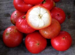
Kokam is a fruit which is often halved and dried, so that the dried seeds are visible in their chambers like a citrus fruit. It is available in the dried form and it is dark purple to black, sticky and with curled edges resembling a thick plum skin. When added to food it imparts a pink to purple color and sweet and sour taste.
Similar to tamarind, kokum skins are usually infused in hot water. The deeper the color the better the kokum. Kokum especially enhances coconut-based curries or vegetable dishes like potatoes, okra or lentils. Kokum is especially used with fish curries, three or four skins being enough to season an average dish. It is also included in chutneys and pickles.
The skins are not usually chopped but are added whole to the dish. Seasoning should be checked as they are quite salty. Beware of biting on a stone as a few are often left in the skins.
It will keep in an airtight jar for about a year.
Kokam which is grown along the Konkan coast in Konkan, Malabar and Kanara regions of Western Maharashtra, not only makes for a tangy cold drink but it is also a medicinal fruit that counters acidity and indigestion. It is also an essential ingredient in the sol kadhi served in various fish joints in Mumbai.


HEALTH BENEFITS OF KOKUM :
Little is known about these tangy, purple berries native to India. Used widely in refreshing drinks and coastal curries, kokam offers a wide range of medicinal properties. Read on to find out what these pretty fruits can do for you and what you can do to max out the health benefits of kokam.
Kokam (botanical name: Garcinia indica), is a deep purple fruit that is very similar to Mangosteen. The tree is native to the Western Ghats and Konkan regions of India and the fruit is commonly used in west-Indian cuisines. Various parts of the tree such as the seeds and bark of the root are used in Ayurvedic preparations since they offer a myriad of health benefits.

Dried Kokam fruit rinds are widely used in cooking as they impart a sweetish-tangy flavor to the food. The fruits contain citric acid, acetic acid, malic acid, ascorbic acid, hydroxycitric acid and garcinol.

MEDICINAL PROPERTIES AND APPLICATION:
· Kokam fruits contain rich amounts of anti-oxidants that bind with free radicals and prevent oxidative damage to body cells. They also promote cell regeneration and repair.
· Kokum juice is especially popular during scorching summer months as it has a cooling effect on the body and shields the body against dehydration and sunstroke. It also helps in bringing down fever and allergic reactions.


Stumble
Delicious
Technorati
Twitter
Digg
Facebook
Reddit
Feed

If you like this please Link Back to this article...


Stumble Upon Toolbar

A SLEW OF MEGA PROJECTS THREATEN THE BIODIVERSITY OF THE KONKAN COAST.

kanchan athalye | Wednesday, September 07, 2011 | Best Blogger Tips
Kashedi Ghat in Ratnagiri district. The area's rich biodiversity is under threat from the seven power projects that will come up within a stretch of 150 km.
A number of mega projects along the Konkan coast in Maharashtra are under public scrutiny. The most recent reason for this is the amendment to the rules governing the Coastal Regulation Zone (CRZ). The rules originally prohibited the setting up of big industries on the coast. The amended version permits them, primarily because of the convenience of transportation by sea. The nuclear power plant at Jaitapur in Rajapur taluka of Ratnagiri district has also drawn public attention to the region. There has been local support for the protests against the nuclear facility, but national attention was focused on the plant in December during the visit of French President Nicolas Sarkozy. It was at that time that a memorandum of understanding (MoU) was signed by the Nuclear Power Corporation of India and the French company Areva, which will supply two nuclear reactors to the 9,900-MW plant.
About 120 kilometres north of the Jaitapur plant are seven other gas- and coal-based power plants with a total capacity of almost 21,000 MW. The State government has also granted permission to mining projects in Mandangad, Dapoli and Dodamarg taluks, all in the Konkan. A further 100 km north on the Konkan coast is another mega project – Mumbai's second international airport, which covers about 2,000 hectares of land right on the coast. Thus, on a stretch of about 200 km, the State government has planned nine gigantic projects. There are also smaller mining leases, small ports and shipyards. Another 15 coal-fired plants, with a total capacity of 25 MW, are reportedly planned along the Konkan.
The Maharashtra government's decision to industrialise the Konkan is at odds with its recognition of the area as a region of rich biodiversity. In 1997, it declared the region eco-sensitive. The zone consists of the Western Ghats, which slope down to the narrow strip of the Konkan coast, which is 50 to 90 km wide. Deepak Apte, Marine scientist and Deputy Director, Conservation, Bombay Natural History Society (BNHS), says that mining in the ghats is already affecting the Konkan and that in the foreseeable future the region will have to battle not only destruction in the ghats but along the coast itself.

The problem lies with the intensity of the industry. “If it had been one power plant, it might have been all right,” says Apte, “but this contiguous development will have a cumulative impact.” The total generating capacity of the power plants will be almost 21,000 MW. Plus, each of the power plants will have its own port that can berth big ships.
These projects have carried out Environment Impact Assessments (EIAs), but on an individual basis. In normal circumstances this would have been acceptable, but the proximity of these projects to each other has to a great extent nullified the individual EIAs. As far as the natural environment is concerned, the effect that will be felt will be a cumulative one. Hence the BNHS' call for a Cumulative Environment Impact Assessment report.
The Konkan coast has maintained its pristine nature to a great degree. Mangroves, mudflats and breeding sites of fish, turtle, birds and molluscs flourish here. There are stretches of coral reefs, and migratory birds are still drawn to the region. There are dolphins and porpoises; even sperm whales have been sighted. In fact, Apte and his team were intent on mapping this coastal ecology when they became aware of the planned industrial development in the region and the damage that could ensue. Their year-long study culminated in a preliminary report on the “Diversity of Coastal Marine Ecosystem of Maharashtra”, which highlighted the region's natural riches and the immense destruction the industries can cause.
The report was submitted to the Ministry of Environment and Forests (MoEF) with the strong recommendation that a Cumulative Environment Impact Assessment study was crucial to the survival of the region's biodiversity. The MoEF agreed to this. The assessment will be the first of its kind in India.
The BNHS report shows that at least 11 eco-sensitive sites will be severely damaged from the thermal discharge from the power plants. Ministry regulations allow thermal discharge to be 7° Celsius hotter than the ambient temperature of the sea water. After receiving the preliminary study, the MoEF altered the norm to 5° C, but Apte says even that will be destructive because of the volume of water.
The report shows that at Mandavi village, which is close to the already constructed Finolex thermal power project, there is danger to a large variety of Opisthobranchs, a diverse group of snails and slugs. A possible new species of sea slug, called Facelina sp, would face threats from changes in water temperature. Mirya village, though not affected by the power plant, is close to Finolex's jetty and the high possibility of an accidental oil spillage leaves the marine life there vulnerable. The report also describes the mangroves along the Jaigad creek as “excellent mangrove cover”, which is “probably among the best mangroves along the Konkan coast as well as Maharashtra”.
At Undi village in Jaigad, Ratnagiri district, a site within the 10-square-kilometre impact zone of the Jindal thermal power plant was assessed. It is proposed to expand the capacity of phase II of the plant, and this will leave local species open to threats. Ambolgad, among the most pristine marine habitats in the Konkan, will be affected by the thermal discharge from the proposed nuclear plant at Jaitapur, which will alter temperature regimes in the water.

The area around the Jaitapur nuclear power plant came in for a close assessment. A radius of 10 km around the site was covered by the team's survey. In all, 45 sites, including five villages in close proximity to the Jaitapur site, were surveyed. The report says that the species diversity of mangroves in the area is high and makes for “very thick and tall forests”. In all 11 mangrove species and nine mangrove associates were recorded from the area. The report says the area around the Jaitapur plant “due to its habitat richness supports great floral and faunal diversity”.
The Jaitapur project, which has been set up by the Nuclear Power Corporation of India, has been opposed by local residents on the grounds of land acquisition and issues of nuclear safety. The tectonic volatility of the region has also been cited. In a letter written in March 2010 to Union Minister for Environment and Forests Jairam Ramesh, the Gandhian Dr G.G. Parikh and the economist Dr Sulabha Brahme, among others, explained why the site was inappropriate.

The waters along the Ambolgad coast, a pristine marine habitat, will be affected by the thermal discharge from the planned nuclear plant at Jaitapur.
“The norm as per Vengurlekar Committee recommendations is that a nuclear power plant shall not be put up in an area which falls beyond seismic zone 1 or 2. The site selected comes under seismic zone 4. The tremors experienced over the years in Koyna valley and Ratnagiri district makes the site inappropriate for a nuclear power plant. The tremors from end September '09 to end December '09 experienced in this region created a crater; 40 ft long & 40 ft deep on a State highway and changed the course of a rivulet, just a few kilometres away from the selected site,” they wrote. They also expressed concern over the “lacs of litres of sea water sucked in and released into sea at higher than the ambient temperature every day…”

Chinchpada village, which will be affected by the Navi Mumbai international airport. Mumbai's second airport.
The environmental clearance for the proposed second international airport for Mumbai took a long time to come. As in the 17 other sites that had been shortlisted for it, there were valid environmental reasons not to build it at Navi Mumbai. It would have violated the CRZ rules had the State not conveniently secured an amendment to accommodate the airport, calling it a “one-time exception”. In the CRZ's 20-year existence, the rules have been amended about 25 times.
So it turned out that over 2,000 ha (at least 30 per cent of it falls in the CRZ category) was earmarked for the airport and its subsidiary facilities. It is astonishing that mangroves, mudflats, wetlands, a creek, riverine topography and a hill were deemed suitable for destruction. The EIA says that the “Navi Mumbai site is less sensitive to environment” and is, therefore, “technically and environmentally [the] preferred site”.
So what exactly happened at Navi Mumbai from a “green” point of view? With the Ministry of Aviation clamouring that the existing Mumbai international airport would be saturated by 2014, Jairam Ramesh ordered a relook at the Navi Mumbai site in February last year. At stake was the destruction of 161 ha of mangrove, the diversion of the Ulwe and Gadhi rivers, the possible siltation of the Panvel creek into which they drain, and the destruction of a hill which, as Ramesh ironically noted, was already partially destroyed by quarrying. Eight months later, the MoEF gave permission to build the airport.
When the announcement was made, much importance was given to the reduction in the distance between the two parallel runways from 1.8 km to 1.5 km. This reduction saved the river Ulwe from diversion without compromising on aviation safety regulations. (If the solution was so simple, why was the Ulwe considered for diversion in the first place?) Much of the existing 161 ha of mangroves will be uprooted and the promised 678 ha of mangrove will come about only after replanting. Besides, it remains to be seen how the diversion of the Gadhi will affect the mangroves. No projections were made on this aspect. So far only 65 per cent of the land has been acquired. The balance 35 per cent is yet to be found and processed. How was environmental clearance given when all the land had not yet been acquired?
At the time of the announcement of the clearance, the then Chief Minister, Ashok Chavan, said the green clearance for the airport was “an important and significant step taken in the interest of Mumbai, Maharashtra, Konkan belt and for the country… it was a classic example for seeking approval for other mega projects”.
Industry usually wins out over environmental considerations. The amendment to the CRZ rules bolsters this belief. Jairam Ramesh himself, at the time of granting clearance to the Jaitapur nuclear project, said that 95 per cent of the project proposals submitted to his Ministry got clearance. However, with the BNHS intervening and the MoEF agreeing to carry out a Cumulative Environment Impact Assessment, there is hope that this story may yet turn out to be one of David and Goliath.

The above article is being compiled and categorised from public domain sites for the best viewer experience. We do not hold any copy rights and it is owned by respective owners of the original information.


Stumble
Delicious
Technorati
Twitter
Digg
Facebook
Reddit
Feed

If you like this please Link Back to this article...


Stumble Upon Toolbar

Tuesday, September 6, 2011

SHIRODA BEACH

kanchan athalye | Tuesday, September 06, 2011 | Best Blogger Tips
 Featuring natural beauty,privacy,sparking blue waters, long stretch of silver sands,cool sea breeze whispering through towering cajurina plantations on the beach, amenities and salt depots around the village shiroda is feast for the eyes of the visitors. In 1930 salt satyagraha took place in Shiroda with the order of Rastrapita Mahatma Gandhi. Police arrested hundred's of protectors ( swayamsevaks) trying to rob salt by breaking the fence, nut they couldn't stop swayamsevaks from looting the salt. This conflict continued till Ghandhiji had talks of equality with General Erwin. Shiroda is also said to be the land of inspiration for eminent novelist V.S.Khandekar.
Stumble
Delicious
Technorati
Twitter
Digg
Facebook
Reddit
Feed

If you like this please Link Back to this article...


Stumble Upon Toolbar

Monday, September 5, 2011

HISTORY OF KONKAN DIVISION

kanchan athalye | Monday, September 05, 2011 | Best Blogger Tips

The name Maharashtra is believed to be originated from rathi, which means chariot driver. Maharashtra entered the recorded history in the 2nd century BC, with the construction of its first Buddhist caves. The name, Maharashtra first appeared in a 7th century in the account of a contemporary Chinese traveler, Huan Tsang. According to the recorded History, the first Hindu King ruled the state during 6th century, based in Badami.
Shivaji Bhosle, the founder of the Maratha Empire, did a lifelong struggle against the Mughals. By 1680, the year of Shivaji's death, nearly the whole of Deccan belonged to his empire. Shivaji was a great warrior and one of the finest rulers of India, so he holds the highest place in Maratha history.
After the Indian independence in 1947, western Maharashtra and Gujarat were combined as Bombay state. In 1956, the geography of the Bombay state was increased with the inclusion of the predominantly Marathi-speaking regions of Marathwada, from the erstwhile Hyderabad state, and the Vidarbha region from Madhya Pradesh. In 1960, the Gujarati and Marathi linguistic areas of the former Bombay state were separated, and the present Maharashtra state came into being.

In 1961 the Konkan region became a part of the newly formed state of Maharashtra.Creation of the Sindhudurg from the southern areas of the Ratnagiri district.The erstwhile Kolaba district was renamed as Raigad.Under Section 3 of the Maharashtra Land Revenue Code, 1966, the State of Maharashtra was divided into revenue divisions, consisting of one or more districts (excluding the City of Bombay). Similarly, under Section 4(1)(i), the State Government could, by notification in the Official Gazette, specify the districts (excluding the City of Bombay), which constitute a division. Greater Bombay consists of the City of Bombay and the Bombay Suburban District.
The City of Bombay was a separate unit, and was not included in a division and was included in the Konkan Division. The City of Bombay had been directly under the State Government, through the Collector and not through the Commissioner of the Division. That position continued, mainly because the erstwhile Bombay Division was always unwieldy. But recently the Revenue Divisions were for administrative convenience and increasing efficiency, reorganized into six Divisions known as Pune, Nagpur, Aurangabad, Konkan, Nashik and Amravati.
To complete this reorganization it was decided to consider the City of Bombay also to be a district and to create a new Bombay Division immediately consisting of the districts of the City of Bombay and the Bomba Suburban District. This would be a viable and compact unit, with the inclusion of the City of Bombay. Later on the intention is to alter and divide the areas of these districts into two or more districts. The Chief Revenue Authority in this Division, as in other Divisions, would be the Divisional Commissioner.
By the Maharashtra Land Revenue Code (Amendment) Act, 1981 (Mah.XLVII of 1981), the City of Bombay was constituted as a district, and a new DIvision by the name of the Bombay Division had been created, with effect from the 29th July, 1981, consisting of the two district of the City of Bombay and the Bombay Suburban District, which was formerly included in the Konkan Division. It was expected that this would help securing greater administrative efficiency and developmental activities. But the experience gained during the period of more than one and half years had shown that there was no special advantage in having a separate Bombay Division, and on the contrary some administrative problems had been created, and considerable inconvenience was being caused. The transfers and promotions in the Revenue Department such as those of Deputy Collectors and Thasildars were Division-wise. With the creation of a separate Bombay Division, it was not easy to transfer officers from or to the Bombay Division, and this had created problems of postings and promotions of the officers, which had involved Government in litigation.
The Commissioner for the Konkan Division continued to hold charge of the post of the Commissioner of the Bombay Division, as it would have been difficult to justify a separate Officer of that status, with his usual staff, for the limited work load of two districts. There was also the difficulty of finding more office accommodation in Bombay. Government therefore, considered it necessary to take action not to continue the separate Bombay Division and to add the areas of the two districts of the city of Bombay and the Bombay Suburban District to the Konkan Division so that the Konkan Division might in future consist of all the six coastal districts of City of Bombay, Bombay Suburban District, Thane, Raigad, Ratnagiri and Sindhudurg.
Konkan Division, rich in verdant natural beauty, is endowed with a coastline of 720 km and exotic agricultural produce including mango, cashew and beetelnut. It includes Thane, Raigad, Ratnagiri and Sindhudurg districts, besides Mumbai and Mumbai Suburban District. The ancient land has produced galaxy of veterans from different walks of life. Sindhudurg is the second district in the country to achieve 100 per cent literacy. Konkan’s beautiful beaches, greenery, Warli art and sea forts attract a steady stream of visitors. The Konkan Railway is an engineering marvel. The country’s first Atomic Power Plant is at Tarapur in Thane district. Also, it has huge fertiliser units, based on natural gas

Stumble
Delicious
Technorati
Twitter
Digg
Facebook
Reddit
Feed

If you like this please Link Back to this article...


Stumble Upon Toolbar

RATNADURGA - RATNAGIRI FORT

kanchan athalye | Monday, September 05, 2011 | Best Blogger Tips

Ratnagiri Fort or Bhagvati FortRatnagiri, also known as Ratnadurg, or Bhagwati, fort is situated about 220 km south of Mumbai. The Bijapur sultans built the fort in the sixteenth century but it was renovated by Shivaji in 1670, serving as an important base for the Maratha navy. The fall of the hereditary Angre admirals also meant the decline of Ratnagiri as a naval base of any military significance.The fort, easily accessible by road, comprises three fortified peaks. The largest, to the south, is called Parkot and supports a functional lighthouse on its western edge. There are hardly any traces of the middle peak, Peth fort, but the Bale Kila, or citadel, is still well preserved and houses the famous Bhagwati Temple.
Beyond the temple is a cliff with a sheer drop from where it is said that condemned prisoners were thrown to their death. There are also some old caves on the western face of the cliff.

Stumble
Delicious
Technorati
Twitter
Digg
Facebook
Reddit
Feed

If you like this please Link Back to this article...


Stumble Upon Toolbar
TOP
To Get Latest Update Subscribe Now !!!