Showing posts with label FORTS IN KONKAN. Show all posts

Wednesday, January 26, 2011

FORT MANDANGAD

kanchan athalye | Wednesday, January 26, 2011 | Best Blogger Tips
Bankot Fort or Fort Victoria or HimmatGad (als...

Mandangad and Bankot were built to safeguard the trade route through Savitri River, which was an important trade route.

It is said that Mandangad was built by King Bhoj. In 1661 it was under Jaswantrao Dalvi, an Adilshahi Sardar. He was the person who had besieged Vishalgad during Shivaji Maharaj’s daring escape from Panhalgad. When Shivaji Maharaj defeated Kartalabkhan and was marching towards Dabhol, Mandangad was on the way. Hearing this news, Jaswantrao ran away to Shringarpur and Shivaji Maharaj got it without a fight. It was with Angres and Siddis for some time. The British captured it in 1818.
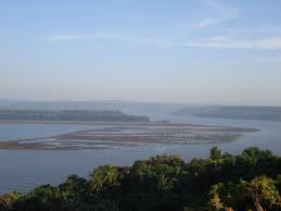
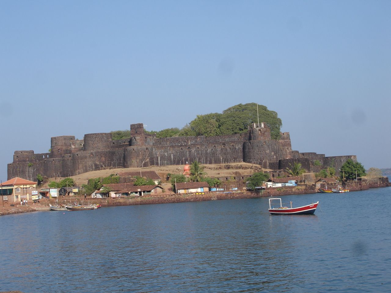
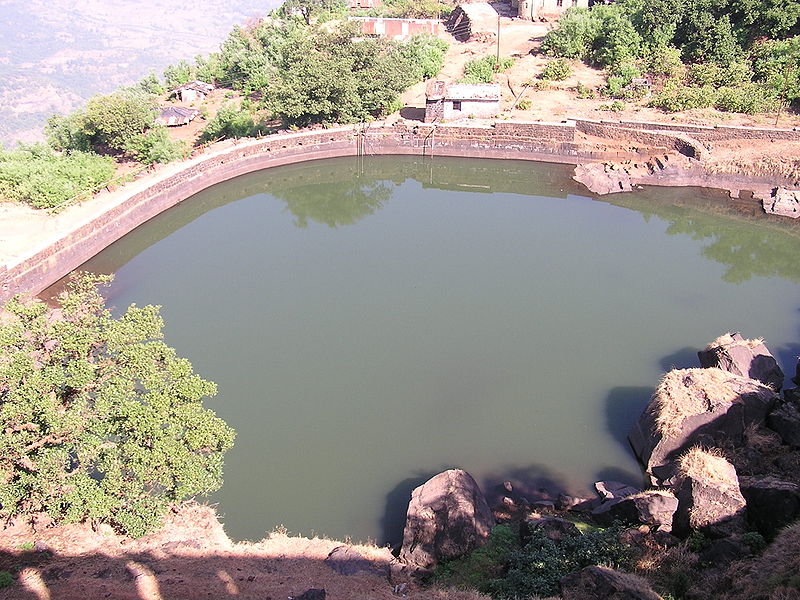
There are 2 summits for the mountain on which Mandangad is built. On the higher one there is a water tank. The fortification is seen on the lower and more flat part. The entrance is destroyed, but the bastions stand. The Ganesh temple here is reconstructed. We can see Savitri River, Raigad and Varandha pass on a clear day.
Enhanced by Zemanta
Stumble
Delicious
Technorati
Twitter
Digg
Facebook
Reddit
Feed

If you like this please Link Back to this article...


Stumble Upon Toolbar

FORT KARNALA

kanchan athalye | Wednesday, January 26, 2011 | Best Blogger Tips
Karnala fort, Maharashtra, India
Its exact date of formation is not known but likely it predates 1400 CE as under the Devagiri Yadavs(1248–1318) and under the Tughlaq rulers(1318–1347), Karnala was the capital of the north Konkan districts of their respective empires. It later fell under the command of the Gujarat Sultanate but in 1540 was taken over by Nizam Shah of Ahmednagar. The Gujarat sultans then requested the help of the Dom Francisco de Menenzes the commanding officer of the Portuguese at Bassien(modern day Vasai) to win it back. He ordered 500 of his soldiers to Karnala fort and they were able to capture it. The fort was left in charge of the Gujarat Sultanate but with Portuguese garrisons.
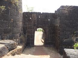
Entrance to Karnala fort, Maharashtra, India
The loss of Karnala enraged the Nizam Shah and he took back the fort and the surrounding countryside by sending 5,000 of his men. The Gujarat sultans fled to Vasai in panic and gave up any claims of the fort to the Portuguese. In the subsequent battle between the Nizam Shah and the Portuguese, the latter were victorious in repulsing further attacks of the Nizam Shahi army and the fort remained with the Portuguese. However the Portuguese viceroy determined that the forts of Sangli and Karnala were of little value to them and decided to give them to the Nizam Shah for an annual payment of Rs. 17,500(or 5,000 gold pardoas) to further their friendship.
Shivaji conquered it from the Portuguese in 1670 by building breastworks as he advanced. After his death in 1680 it was taken over by Aurangzeb. After this the Mughals occupied it for some time after which it in 1740 with the rise of the Peshwas of Pune it went to them. It remained under the command of killedar (garrison commander) Anantrao until a colonel Prother won the fort and established the rule of the British East India Company there in 1818.
Karnala fort actually consists of two forts one at a higher level and other lower. At the centre of the higher level is a 125 feet high basalt pillar. It is also called Pandu's tower. This structure was used as watchtower when the fort was occupied however now it is in a ruined condition. The presence of bee hives also makes it difficult to climb and have resulted in at least one casualty in recent times. There is a water cistern which provides fresh water all year long. From the top the forts of Prabalgad and Rajmachi are clearly visible.
The fort has two inscriptions one in Marathi and the other in Persian. The Marathi inscription which has no date is seen on the lower gate on the inner side. Its words are indecipherable. The Persian writing is on upper gate reads "Syed Nuruddin Muhammad Khan, Hijri, 1147 AH (1735 CE) and probably dates from the Mughal occupation of the fort.

Enhanced by Zemanta
Stumble
Delicious
Technorati
Twitter
Digg
Facebook
Reddit
Feed

If you like this please Link Back to this article...


Stumble Upon Toolbar

Sunday, January 23, 2011

FORT YESHWANTGAD

kanchan athalye | Sunday, January 23, 2011 | Best Blogger Tips
 Yashvantgad Fort, on the north entrance of the Rajapur creek, with the sea on the south and a ditch to the north and west, has an area of about seven acres. In 1862, the walls and gates with their seventeen bastions needed repair. There was no garrison, and only twenty-eight old unserviceable guns. [Gov. List of Civil Forts, 1862.] The supply of water and provisions was abundant.

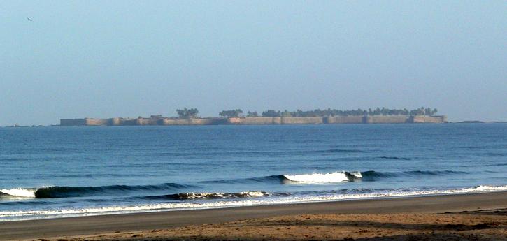
Yeshwantgad is an island fortification off the coast of Maharashtra in Ratnagir, district. It is built on the Rajapur, creek with the sea on one side. On three sides it was protected by a ditch which can no longer be seen. On the fourth side there was a wall with 17 bastions. Now the walls are in a ruined condition. Its gate was on the eastern side. A ship (HMS Outram sank here on the 1st January, 1817 after which a lighthouse at nearby Jaitapur was built. Other than this no notable historical events took place here.


Stumble
Delicious
Technorati
Twitter
Digg
Facebook
Reddit
Feed

If you like this please Link Back to this article...


Stumble Upon Toolbar

Saturday, January 22, 2011

FORT NIVTI

kanchan athalye | Saturday, January 22, 2011 | Best Blogger Tips
 Nivti Port, in the village of Kochra, six and a half miles south of Malvan and eight north of Vengurla, stands at the mouth of a small creek in rather a striking bay. Rennell (1788) suggested that Nivti was Ptolemy's (150) Nitra and Pliny's (77) Nitrias, ' where the pirates cruized for the Roman ships'. But this is very doubtful, and as far as has been traced, Nivti has never been of importance as a centre of trade. [Rennells Memoir of a Map of Hindustan, 31. Nitra or Nitrias is more commonly identified with the Periplus (247) Naoura and so probably with Honavar (Lassen's Ind. Ant. III. 67). In 1819 its trade was insignificant, Malvan Resident to Gov. 31st May 1819; Revenue Diaries 141 of 1819, 2299.] The average yearly value of trade, for the five years ending 1877-78, was £3167 8s. (Rs. 31,674) of which £2604 16s. (Rs. 26,048) represented exports and £562 12s. (Rs. 5626) imports. [Nairne's MS. Tieffenthaler (Res. Hist et. Geog. I 513) described it (1760) as a very scarped rock strengthened with seven towers. It had a ditch on the land and was inaccessible from the sea.]

Nivti fort, on a very picturesque and well wooded headland about 150 feet high, is a complete ruin. [Nairne's Konkan, 105.] In 1786 it was taken by the Kolhapur troops and soon after restored to Savantvadi. [A wing of the 89th Regiment; 2½ battalions native infantry; 3 troops of native cavalry and artillery. Nairne's Konkan, 127.] In the early years of the present century (1803 and 1810), after being taken and retaken by these rival chiefs, it in the end remained with the Savants. In 1818, when British power was established, the southern villages continued to suffer from the raids of the Savantvadi garrisons of Nivti and Redi. Under Sir W. G. Keir a force [The details were: the head-quarters of the IVth Rifles, crossing the river at Karli, arrived before Nivti. on the 2nd February 1819. On the 3rd the batteries opened and on the following day the fort capitulated and was taken. Service Record of H. M.'s IVth Rifles, 29.] was sent into the Konkan, and on the 4th February 1819 Nivti was invested and given up without resistance. [Gov. List of Civil Forts, 1862.]
Stumble
Delicious
Technorati
Twitter
Digg
Facebook
Reddit
Feed

If you like this please Link Back to this article...


Stumble Upon Toolbar

Tuesday, January 4, 2011

FORT AMBOLGAD

kanchan athalye | Tuesday, January 04, 2011 | Best Blogger Tips
The Fort of Ambolgad was primarily built to keep an eye on the ancient port of Musakaji and the surrounding seas. Col. Imlock captured this Fort for the British in 1818. The residential portion of Ambolgad was shifted out completely by 1862.

Ambolgad is situated at a height from the main sea level. The total area covered by the Fort is approximately 1200 Sq. Metres. It has the sea guarding it from the South and has deep moats on the northern and western side. The current condition of the fort is very bad. A small part of the fortification and walls on the sea side are still visible. Apart from this, there is a square well and remnants and plinths of various constructions in the fort. The Math of Gagangiri Maharaj is situated near the Fort.
Stumble
Delicious
Technorati
Twitter
Digg
Facebook
Reddit
Feed

If you like this please Link Back to this article...


Stumble Upon Toolbar

Wednesday, December 22, 2010

KILLE SUVARNADURG

kanchan athalye | Wednesday, December 22, 2010 | Best Blogger Tips
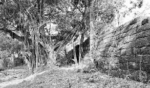
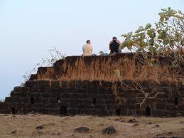
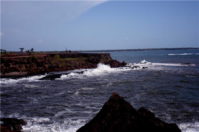
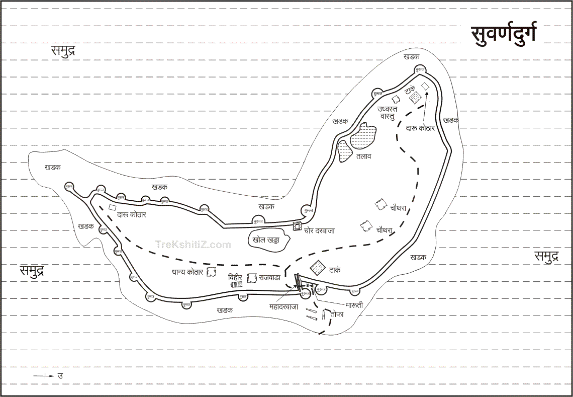
Suvarnadurg is a fort that is located on a small island in the Arabian Sea, near Harne in Konkan, along the West Coast of India, in the state of Maharashtra. The fort also includes another land fort (small) called the Kanakadurga at the base of headland of Harne port on the coast. Building of the fort is credited to Sultan Adilshah of Bijapur. The forts were captured by Shivaji, founder of the Maratha Empire, in 1660. 

Subsequently, Shivaji, other Peshwas and the Angres further fortified the forts for defence purposes.
The literal meaning of Suvanadurga is “Golden Fort” as it was considered as the pride or the “ feather in the golden cap of Marathas”. Built for the Maratha Navy for defence purposes, the fort also had a ship building facility. The basic objective of establishing the fort was to counter enemy attacks, mainly by the colonialists of Europe and also by the local chieftains. In the past, the land fort and the sea fort were connected by a tunnel, but now defunct. The present approach to the sea fort is only by boats from the Harne port on the headland.
The fort is on an island in the Arabian Sea on the west coast within the jurisdiction ofRatnagiri District, off the Kanakadurga fort and below the headland Harne port. Kanakadurga, the harbour fort, built originally as a strategic link to the sea fort has a lighthouse. Harne, near the dilapidated Kanakadurg fort, is an important harbour, which is right on the edge of the land that protrudes into the Arabian Sea. This is a natural harbour known for large fishing and marketing. It is conjectured that the Kanakadurga fort and other land side forts such asBankt Fort, Fategad fort and Goa fort were built primarily as look out forts for the security of the Suvarnadurg fort. There is no landing jetty at the Suvarnadurga fort. However, the landing is on the shores of the sandy beach of the rocky island. Another feature of the area is that a narrow channel separates the Gova, Kanakadurg and Fattehgarh forts on the mainland.
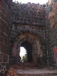
The forts have recorded history linked to the Adil Shah Dynasty (1490 to 1686) of theBijapur Sultanate. However, linking its history to an earlier era of the Satavahana (230 BC to 220 AD) is considered a speculation since no proof could be established to this claim. The forts were captured by Chatrapati Shivaji in 1660 by defeating Ali Adil Shah 11 (1656–1672). Kanhoji Angre (1667–1729), popularly known as “Samudratla Shivaji” was the Admiral of theMaratha Navy; in 1696, Kanhoji's naval fleet was stationed here. However, the fort was formally handed over to Kanhoji in 1713 by Shahu Raja.
Kanhoji Angre who was also known as Angria was appointed in 1698 as Admiral of the Maratha Naval Fleet by thePeshwas. He had complete control over the west coast, from Mumbai to Vingural, except for the fort of Janjira, which remained with the British (for 200 years). Angre was considered to be a mercenary who attacked defenceless towns and also traders. He even attacked the East India Company’s ship in 1702 and refused to release the British captives (six of them). He severed his relations with the Peshwas in 1704 and was called “the Rebel Independent of the Raja Shivaji”. In spite of warning by the British that he should not attack or capture British ships, he captured their ships in 1707. He had a free run of the west coast from Surat to Dabhol and captured all private vessels. When Shivaji’s grandson was imprisoned, Kanhoji got his opportunity to stake his claim for independence. In 1713, he had captured Peshwa’s general Bhairu, which forced the Peshwa general Balaji Rao (Commander-in-Chief of the Maratha forces) to come to an agreement with him. For maintaining "fealty" with the Sataras (Chatrapati Shivaji's family stronghold), he was granted 26 forts and its dependent villages, which included Suvarnadurg. In subsequent years, these forts became strong holds for piracy. With his new ordered control, Kanhoji held complete control over a coast line stretching over a coast length of 240 miles (390 km) and 40 miles (64 km) width extending from Mumbai to Vingurla to the south. He later entered into an agreement with the British, which went against him as the British flouted all terms with him. Humiliated by this treatment by the British he decided to attack them. He entered into an alliance with the Raja of Satara, equipped his vessels and manned them by the best crew consisting of Dutchmen. He also employed a Jamican pirate as his chief gunner. Many European pirate forces had also joined his army after the Treaty of Utrecht of 1713-14 (comprising a series of individual peace treaties among several European states includingEngland, France and Spain, among others). With this force, he terrorized the East India Company.

Kanhoji relentlessly carried on his fight against the British and in 1721 joined hands with thePortuguese; when 33 British soldiers were killed, 21 wounded and many ammunition and field guns were seized by the Marathas. In 1722, when Kanhoji was to attack the English factory at Karwar, in spite of the British sending their ships 'Victoria' and the 'Revenge' to attack Kanhoji's forces, he was not cowed down; even though his Dutch Commander was killed and his 16 ships were captured. However, he died on 4 June 1729, an unvanquished hero for 31 years against all foreign attacks. It is said that "Had he been in England, like Drake, he would have been knighted and lionised as a national hero, but in India he died merely as an independent ruler who never permitted any foreign ruler to filch even a part of his precious little dominion”.
He had two legitimate and two illegitimate sons, and Sambaji his legitimate son was given control of Suvarnadurg. Following the death of one of the brothers in 1734, there were intence fights and acts of piracy continued. In spite of attacks by the British in 1732, Sambaji was back in Suvarnadurg unharmed. However by 1749, Tulaji, the step brother of Sambaji, had become very powerful and his ships sailed unharmed, even much bolder than what his father Kanhoji had achieved. This situation forced the Peshwas to join hands with the British to suppress Tulaji. In 1755, they jointly attacked Tulaji’s strong hold of Suvarnadurg and took control of the fort within 48 hours. Suvarnadurg was then given to the Peshwas that was considered a humiliating surrender by the Peshwas to the British.
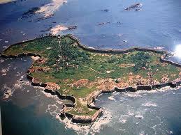
Subsequent to Kanhoji's demise, Tulaji Angre took charge of Suvarnadurg and it became the seat of his power. However, he fell foul of the Peshwas. He was considered arrogant. In the war with Tulaji, Peshwas were supported by the British. The joint siege of the fort lasted from March 25 to 2 April 1755. On 12 April 1755, Commodore James captured the fort and formally handed it over to the Peshwas. However, this support proved detrimental to the Peshwas, as the British extracted, as a reward, control over the Bankot fort but only allowed the Peshwas to have control over the Suvarnadurg. In 1802, Bajirav Peshwa under attack by the Holkars was trying to take refuge in this fort but had to flee to Vasai as he was chased to the fort by the Holkars. In 1818, Captain William of the British army attacked the fort and took full control of it on 4 December 1818. Soon thereafter the other forts also came under British control. The fort was thus under the control of the Peshwas till 1818. The fort has witnessed a scene of “triumph and tragedy, of the display of heroic courage and abject cowardice.”
The Angrias are also credited with not only strengthening the fort but also establishing the ship building yard at Suvanadurg and creating a large fleet of warships to secure the west coast, the Konkan coast, from attack from theBritish, French, Dutch and Portuguese colonialists. It is also inferred that the small forts (Goa, Kanakadurga, Bankot fort, Fattegad fort and Goa fort) were primarily built by Kanhoji Angre to defend Suvarnadurg from any enemy attack from the land route.
Stumble
Delicious
Technorati
Twitter
Digg
Facebook
Reddit
Feed

If you like this please Link Back to this article...


Stumble Upon Toolbar

KILLE JANJIRA (MURUD – ALIBAG)

kanchan athalye | Wednesday, December 22, 2010 | Best Blogger Tips
Murud-Janjira is the local name for a fort situated at the coastal village of Murud, in the Raigad district. It is famous for being the only fort along India's western coast that remained undefeated despite Maratha, Dutch and English East India Company attacks.

The word Janjira is not native to India, and may have originated after the Arabic word Jazeera, which means an island. Murud was once known in Marathi as Habsan, or Abyssinian's land. Some of the people also split the name as "JAL JEERA" meaning fort in the water.

 The name of the fort is a concatenation of the Konkani and Arabic words for Island, "morod" and "jazeera".The word "morod" is peculiar to Konkani and is absent in Marathi.Thus, during the rains, the fields get flooded,but the morods never flood.The State of Murud-Janjira was known to the Maratha Empire as Habsan,the land of the Habshis.

It is really good to see this fort. the coventers of this fort is really different from other forts.Sambhaji Maharaj (Son of Chatrapati Shivaji Maharaj)constructed a fort on a nearby island (Padmadurg Fort, now known as Kasa). Kasa is not accessible to the public and requires special permission from the Navy.

Murud doesn't just have a Beach & the fort. It also has a Temple over the hill next to the New Bus Depot (known as Datta cha Dongar) Hill of Lord Dattatray. One can have a paranormic view of Murud  both the islands together from the hill.

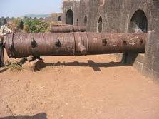
Further ahead of the hill is an idga, the walk though the dense jungle is a experience in itself. The fort also boasts of a sweet water lake inside it. It is considered to be a miracle that the Fort surrounded by the salty water of the sea has a lake full of sweet water. Also the cannons in the fort are quite unique. The biggest cannon boasts a range of around 18 km. It is said that since the entire cannon could not have been transported at once they had to be brought in pieces and they were then assembled inside the fort.
When the rulers of the fort gave up their rule they settled in a near by village and named it Rajpuri (meaning end of the Rule, Raj = Rule and Puri = End)
Enhanced by Zemanta
Stumble
Delicious
Technorati
Twitter
Digg
Facebook
Reddit
Feed

If you like this please Link Back to this article...


Stumble Upon Toolbar

Sunday, December 12, 2010

KILLE JAIGAD

kanchan athalye | Sunday, December 12, 2010 | Best Blogger Tips

Last village in Ratnagiri Tehsil is Jaigad. After crossing the creek in the village, one reaches the Guhagar Tehsil. Jaigad is the natural port and famous since ages. When major transportation was by sea – routes. This is one of the rare ports where ships can directly berth to the jetty. This was the major port in 50’s when Goa – Mumbai ship service was in full stream. Over the time with advent of national highways and closure of ship services, Jaigad lost its glamour and now is a remote port.

Lighthouse situated in the fort guides ships traveling between Dabhol (near Dapoli) and Ratnagiri. With the proper development of this natural port, Jaigad can once again be the hub of marine activity and has the potential to become an alternative port to Mumbai. Its scenic location and natural port facility are the silent features of the Jaigad Fort.
Enhanced by Zemanta
Stumble
Delicious
Technorati
Twitter
Digg
Facebook
Reddit
Feed

If you like this please Link Back to this article...


Stumble Upon Toolbar

Monday, December 6, 2010

FORT SINDHUDURG

kanchan athalye | Monday, December 06, 2010 | Best Blogger Tips
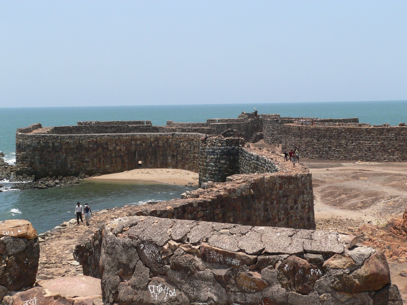
Sindhudurg (Sindhu = sea, Durg = fort) was built by the great Maratha warrior King Shivaji in 1664. Shivaji selected the strategic rocky island location, then known as 'Kurte' for the fort ,himself - to counter foreign forces, and to keep the nearby Siddis of Murud-Janjira in check.


Structural Details:
Over 4000 mounds of iron were used in the casting and foundation stones were firmly laid down . The construction was started on November 25, 1664. Built over a period of thirty years, the sea fort is spread over 48 acres (190,000 m2) with a two-mile (3 km) long rampart, and walls that are 30 feet (9.1 m) high and 12 feet (3.7 m) thick. The massive walls were designed to serve as a deterrent to approaching enemies and to the waves and tides of the Arabian Sea. The main entrance is concealed in such a way that no one can pinpoint it from outside.At a time when Samudra Gaman (travelling by sea) was banned by scriptures, this construction on an island represents the revolutionary mindset of its builder.

About The Families Staying In The Fort:
Families staying at the fort are known as Mavlas, who were the soldiers during the king's regime and they are known to be their ancestors. Basic occupations for them are farming, fishing and guiding tourists in the fort. Among the 15 families there are two Muslim families who are given the responsibility of playing the drum (Nagara) in the evening at the time of prayers and that practice has been followed since the king's regime as no one else was allowed to do that as Shivaji Maharaj never discriminated among religions. The houses the locals staying on the fort are very much the same since they were built ,the locals inhabiting the area can renovate the house interiors, but not the exterior, and also cannot sell their houses. As there are no hospitals, no shops, no facilities, life is difficult on the fort. The only mode of transport is waterways which,again,is risky.

Attractions At The Fort:
(1)There are three sweet water reservoirs in ramparts of the fort , and even if the water in the nearby villages dries in summer, these wells do not dry; they always contain water in them.
(2)There is a coconut tree which has a branch, if you see a coconut tree it will never have a branch but this tree not only has a branch but also gives fruit. This tree was struck by lightning a couple of years ago.
(3)There is a passage which is hidden in a temple which looks like a water reservoir, this passage goes under the fort for 3 kilometers, and 12 kilometers beneath the sea, and from there 12 kilometers in a nearby village which was used as a rescue door if the enemy entered the fort; this way was for the women to move out.However,this passage has been partially closed to public view,ever since it was abandoned, by the British rulers.
(4)The entrance gate is hardly visible from anywhere, and unless you are not a regular visitor, and if you are not and you are trying to enter through a boat which is the only possible option apart from air, you would bang at the rocks around the fort which can't be seen to naked eyes, hence you have to be very familiar with the fort ,to enter.
(5) A handprint and a footprint of Shivaji Maharaj is also embedded in one section of the fort. There is also Atmeshwar Mandir ,a famous Shivling, and is beautiful place for Adhyatmik Sadhana (Spiritual Activities).
(6)There is a Temple of Shivaji Maharaj, built by his son Rajaram: The only temple of Shivaji in the world.in this temple,festivities like Shivaji Jayanti(birthday of Shivaji),Ram Navami,Janmashtami,Mahashivrathri,Ganesh Chaturthi,etc also take place.
(7) Daily Pooja(worship)and maitainance is done by mainly two families-that were assigned this job since the fort was built, one of them is Shriram Sakpal.
Stumble
Delicious
Technorati
Twitter
Digg
Facebook
Reddit
Feed

If you like this please Link Back to this article...


Stumble Upon Toolbar

Sunday, December 5, 2010

FORT VIJAYDURG

kanchan athalye | Sunday, December 05, 2010 | Best Blogger Tips
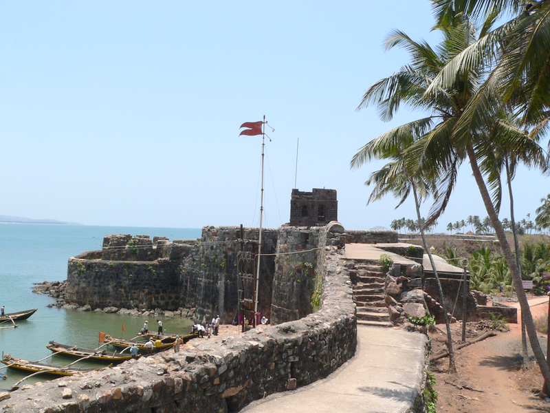
 Vijaydurg, which literally means "Victory Fort", is a fort built by Shivaji in the Sindhudurg district in Maharashtra. The main purpose of building this fort was to defend the shoreline on the Arabian Sea. This fort is a complex in itself, having a commander's house and three lines of defences. The three fortified walls stand proud and tested by time and the unforgiving sea.

Vijaydurg Located in Devgad Taluka, Vijaydurg is famous all over the world for its delicious Alphanso Mangoes, and this becomes quite evident on the approach to Devgad. Mango plantations are everywhere as it is alongside fishing and farming, the main occupation of the people in Devgad.

The Vijaydurg fort was built by Shivaji at the mouth of Vaghotane creek. The fort is on a peninsula into the sea and is spread in an area of six hectares. The fort has 27 bastions and is still in a very good condition. The huge stones used for the fort walls and the strength of the walls are still visible, and it is quite interesting to think how these huge walls were built in the open sea.
Stumble
Delicious
Technorati
Twitter
Digg
Facebook
Reddit
Feed

If you like this please Link Back to this article...


Stumble Upon Toolbar

Saturday, December 4, 2010

FORT RAIGAD

kanchan athalye | Saturday, December 04, 2010 | Best Blogger Tips


Raigad fort is beautiful 695-715 Muhammad bin Qasim was also an excellent administrator. He established peace and order as well as a good administrative structure in the areas he conquered. He was a kind hearted and religious person. He had great respect for other religions. Hindu and Buddhist spiritual leaders were given stipends during his rule. The poor people of the land were greatly impressed by his policies and a number of them embraced Islam. Those who stuck to their old religions erected statues in his honor and started worshiping him after his departure from their land.

Muhammad bin Qasim was known for his obedience to the ruler. Walid bin Abdul Malik died and was succeeded by his younger brother Suleman as the Caliph. Suleman was an enemy of Hajjaj and thus ordered Qasim back to the kingdom. Qasim knew of the animosity between the two. He was aware that due to this enmity, he would not be well treated. He could have easily refused to obey the Caliph's orders and declare his independence in Sindh. Yet he was of the view that obeying ones ruler is the duty of a general and thus he decided to go back to the center. Here he became a victim to party politics. He was put behind bars where he died at age of twenty. Many historians believe that had he been given a few more years, he would have conquered the entire South Asian region. acording the tarekh hind after his mohammaden ruler invaded the darul harab and set up the kingdom ship of islamic pattern peace justice and sorveinty and equality. After his expedition across the Gangetic plains in 1017, of Al-Biruni to compose his Tarikh Al-Hind in order to understand the Indians and their beliefs.the fort of Rai IS built by the mohammaden ruler of ghazni this Hazrat Madar Shah Sahib somany time sighted on the hill the dead body and said, “hey Jamaluddin Janeman Jannati, get up with the orders of the almighty Allah the miracles of the wali- zinda peer,hence the sultan mahmoud built fort of black stone massonary of Islamic art of fort. now the present situation somany arbic persion calligraphic foundation stone widrawl by the local feneticpersons and paste the old animal goddess stone during shivaji period.but the historian albiruni recorded it in persion of the fort history in Tarik-e-lhind.
The Bahamanis,1347-1489. From the beginning of their rule in 1318, the Deccan Musalmans seem to have held ports in Kolaba of which Ceul was one [Briggs Ferishta, II, 295]. Under the Bahamanis (1347-1489) the change of capital from Daulatabad south to Gulbarga caused the chief traffic to pass to the Ratnagiri ports of Dabhol, Ciplun and Rajapur Still Ceul remained a place of importance, as in 1357 when Hasan Gangu distributed his territory into four provinces, the northwest province is described as comprehending Ceul, Junnar, Daulatabad, Bid and Paithan [Briggs Ferishta, II, 295].

Maratha defeat, 1671. Kasim followed up his success by gaining six or seven forts in the neighbourhood of Danda-Rajpuri. From the beginning of their rule in 1318, the Deccan Musalmans seem to have held ports in Kolaba of which Ceul was one [Briggs Ferishta, II, 295]. Under the Bahamanis (1347-1489) the change of capital from Daulatabad south to Gulbarga caused the chief traffic to pass to the Ratnagiri ports of Dabhol, Ciplun and Rajapur Still Ceul remained a place of importance, as in 1357 when Hasan Gangu distributed his territory into four provinces, the northwest province is described as comprehending Ceul, Junnar, Daulatabad, Bid and Paithan [Briggs Ferishta, II, 295]. Muhammad II who ruled from 1378 to 1397 was an enlightened rider. When his kingdom was ravaged by famine he made prompt and efficient arrangement for the transport of grain from Gujarat and Malva and its distribution among Muslims only at cheap rates. He established orphanages in various centres in the kingdom two of which were at the Konkan ports of Ceul and Dabhol Six forts surrendered after one or two days, but the commandant of the seventh held out for a week and then capitulated on terms, which Kasim faithlessly violated. Kasim granted quarter to the garrison and seven hundred persons came out. He made the children and pretty women slaves, and forcibly converted them to Islam; the old and ugly women he set free and the men he put to death. Kasim sent news of his victory to prince Muhammad Muazzam, governor of the Deccan, and to Khan Jahan. Both he and his brother Sidi Khairiyat had their rank raised and were presented with robes of honour Khafi Khan in Elliot and Dowson, VII.. This must have been Muazzam's second governorship 1667-1672. In September 1671, Shivaji sent an ambassador to Bombay to secure the aid of the English in an attack on Danda. But the President and Council at Surat advised Bombay neither to promise, nor to deny him any help as they did not think it convenient to help him against Danda, which place, if it were in his possession, would prove a great annoyance to the port of Bombay. Towards the end of 1672, Aurahgzeb sent a fleet of 36 vessels from Surat to assist the Sidi of Danda-Rajpuri by causing a diversion by sea. This squadron did Sivaji great mischief, burning and plundering all his seaport towns and destroying above 500 of his vessels, (evidently trading boats).

Shivaji Maharaj had seized the site, then the fortress of Rairi, from the royal house of the Chandrarrao Mores, a junior or Cadet Dynasty descended from the ancient Maurya imperial dynasty. The last More king (or raja) was a feudatory of the Sultan of Bijapur. Shivaji renovated and expanded the Fortress of Rairi and renamed it Raigad (the King's Fort), the name he gave it when he selected it for his capital when he founded the Maratha empire. Raigad, a hill fortress situated in Raigad district of Maharashtra, India was capital of Shivaji's kingdom.
The fort's ruins today consist of the queen's quarters, consisting of six chambers, with each chamber having its own private restroom with plumbing. The main palace was constructed using wood, of which only the bases of pillars remain. Ruins of three watch towers can be seen directly in front of the palace grounds overlooking an artificial lake called Ganga Sagar Lake created next to the fort. It also has a view of the execution point called Takmak Tok, a cliff from which the sentenced prisoners were thrown to their death. This areas is now fenced off. The fort also has ruins of the market, and it has such structure that one can shop even while riding or sitting astride a horse.

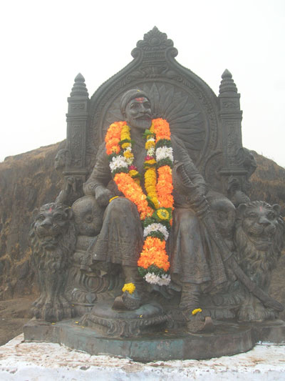
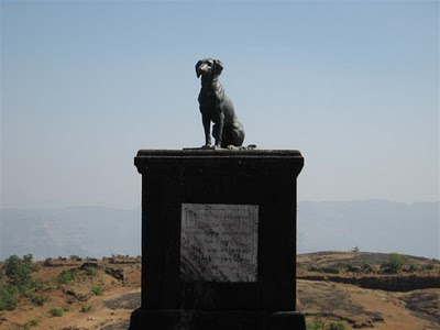
The king's public Durbar has a replica of the original throne that faces the main doorway called the Nagarkhana Darwaja. This enclosure had been acoustically designed to aid hearing from the doorway to the throne. A secondary entrance, called the Mena Darwaja, was supposedly the private entrance of the royal ladies of the fort; it leads to the queen's quarters. The erstwhile main entrance to the fort is the imposing Maha Darwaja. The convoy of the king and the king himself used the Palkhi Darwaja. To the right of Palkhi Darwaja, is a row of three dark and deep chambers. Historians believe that these were the granaries for the fort. A statue of Chhatrapati Shivaji is erected in front of the ruins of the main market avenue that eventually leads to the Jagdishwar Mandir and his own Samadhi(tomb) and that of his dog Waghya.
Enhanced by Zemanta
Stumble
Delicious
Technorati
Twitter
Digg
Facebook
Reddit
Feed

If you like this please Link Back to this article...


Stumble Upon Toolbar

FORT RATNADURGA

kanchan athalye | Saturday, December 04, 2010 | Best Blogger Tips
 Ratnagiri Fort or Bhagvati FortRatnagiri, also known as Ratnadurg, or Bhagwati, fort is situated about 220 km south of Mumbai. The Bijapur sultans built the fort in the sixteenth century but it was renovated by Shivaji in 1670, serving as an important base for the Maratha navy.
The fall of the hereditary Angre admirals also meant the decline of Ratnagiri as a naval base of any military significance.The fort, easily accessible by road, comprises three fortified peaks. The largest, to the south, is called Parkot and supports a functional lighthouse on its western edge. There are hardly any traces of the middle peak, Peth fort, but the Bale Kila, or citadel, is still well preserved and houses the famous Bhagwati Temple. Beyond the temple is a cliff with a sheer drop from where it is said that condemned prisoners were thrown to their death. There are also some old caves on the western face of the cliff. Thibaw, the last king of Burma, was exiled by the British to Ratnagiri in 1885 and put under house arrest in a palace specially built for him.
Stumble
Delicious
Technorati
Twitter
Digg
Facebook
Reddit
Feed

If you like this please Link Back to this article...


Stumble Upon Toolbar

Thursday, December 2, 2010

FORTS IN KONKAN

kanchan athalye | Thursday, December 02, 2010 | Best Blogger Tips
Forts are military constructions and buildings designed for defence in warfare and military bases. Humans have constructed defensive works for many thousands of years, in a variety of increasingly complex designs. The term is derived from the Latin fortis ("strong") and facere ("to make").

For tourist who love to visit historical place especially forts; konkan is the right place to go. Here is a list of popular forts in Konkan region;

Forts in Sindhudurg District:
1. Sindhudurg fort
2. Vijaydurg fort
3. Terekhol fort
4. Nivti fort
5. Ramgarh fort
6. Rangan fort
7. Shivgarh fort

Forts in Ratnagiri District:
1. Ratnadurg fort
2. Suvarnadurg fort
3. Goa fort
4. Gopalgarh fort
5. Padmadurg fort
7. Purnagad fort
8. Kanakdurg fort
9. Mahimandangarh fort
10. Mahipatgarh fort
11. Sumargarh fort
12. Vijaygarh fort
13. Yashwantgarh fort
14. Himmatgarh fort


Forts in Raigad District:
1. Raigad fort
2. Kulaba Fort
3. Knaderi fort
4. Murud-Janjira fort
5. Karnala fort
Stumble
Delicious
Technorati
Twitter
Digg
Facebook
Reddit
Feed

If you like this please Link Back to this article...


Stumble Upon Toolbar

KILLE GOPALGAD - FORT GOPALGAD

kanchan athalye | Thursday, December 02, 2010 | Best Blogger Tips
 As a common myth, most of the people believe that forts in Konkan and Maharashtra came into existence because of Shivaji and subsequent Maratha Kingdom in this region. Many of the locals also have strong belief. There is another common myth that Konkan does not have or has very little ancient history, whatever history it has essentially starts with Maratha period. Many forts in Konkan are the living facts which easily disprove these myths.

But question is why so many forts in this narrow hilly tract which is just so obscure part of this country. But the existence of forts prove one thing that these parts were no obscure a few centuries ago, they are not the structures of one's fancy but served a practical purpose. That practical purpose was protection of trade and the people who wanted to do that. Konkan being a coastal region with so many ports which may look small or just nothing these days has been a hotspot for trade for the entire subcontinent. The trade which actually took place on these port towns needed connections with the rest of the country and were origins for trade routes. Three types of forts can be seen in Konkan region. First type of forts are built on islands in the sea e.g. Kille Sindhudurg. Second type of forts is of those which are built near the sea coast or creeks but on mainland. e.g. Kille Vijaydurg. Third type are hill forts e.g. Kille Raigad

Kille Gopalgad, a fort in Ratnagiri district was built on the banks of Vashishti creek. It was built for the protection of Dabhol an ancient port city which also finds its mention by the famous geographer from ancient Greece Ptolemy.

Past:
Gopalgad was first built by Siddisad, a sardar of Bijapur dynasty rulers in 1500's who were controlling the southern Konkan at that time. There is Persian stone inscription about that in the fort. Then it was later on occupied by King Shivaji, King Sambhaji. In 1699, it was captured by Khairatkhan who was a Siddi ruler who ruled from Murud Janjira. Tulaji Angre then won this fort in 1744 and then later lost it to Peshwas in 1755. During the Peshwa rule, the Village of Anjanvel in which this fort is situated was district headquarters and it was a centre for ship building industry and cloth weaving. In 1818 when Peshwas lost to British, the fort also went to them but not easily and they had to fight a battle for it.

Present:
The fort is in poor condition with many walls crumbling. There is one well in the fort almost at the centre around which there are remnants of palace. Some canon balls can be found in the fort. There is a private Mango orchard in the fort and due to ownership issues the entrance to fort is blocked. The fort is surrounded by deep trenches which are now filled again with soil at many places. There are many view points on the fort walls which offer views of creek and Dabhol port. One can easily imagine while looking at them, how the guards used to keep a watch on ships passing through creek and activities which were taking place on the port. Let's hope that government intervenes and restores this important landmark in the history of Konkan, Maharashtra and India.
Stumble
Delicious
Technorati
Twitter
Digg
Facebook
Reddit
Feed

If you like this please Link Back to this article...


Stumble Upon Toolbar

Wednesday, November 24, 2010

TIRACOL FORT

kanchan athalye | Wednesday, November 24, 2010 | Best Blogger Tips
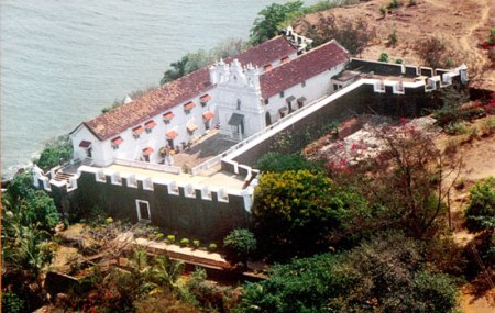
 Goa-Sindhudurga district, on the border of Redi village, we find Tiracol fort. It is on a big hill near the seashore. Though it is in Goa, people visiting Sindhudurga are able to see it.
Fort is situated at the mouth of Redi creek. Towards the south of the fort is the seashore. Redi village is well known for its manganese business. Otavne river meets here to sea and hence the area of beach is very broad. And because of this otavne river, one natural boarder is maintained in sindhudurg and goa. From tiracol fort you can see beautifull view of otavne river where meets to sea.


Enhanced by Zemanta
Stumble
Delicious
Technorati
Twitter
Digg
Facebook
Reddit
Feed

If you like this please Link Back to this article...


Stumble Upon Toolbar
TOP
To Get Latest Update Subscribe Now !!!